Week 20: Near Lake City, CO to Chama, NM

Total Weekly Mileage: 230.2

“Beat Up”

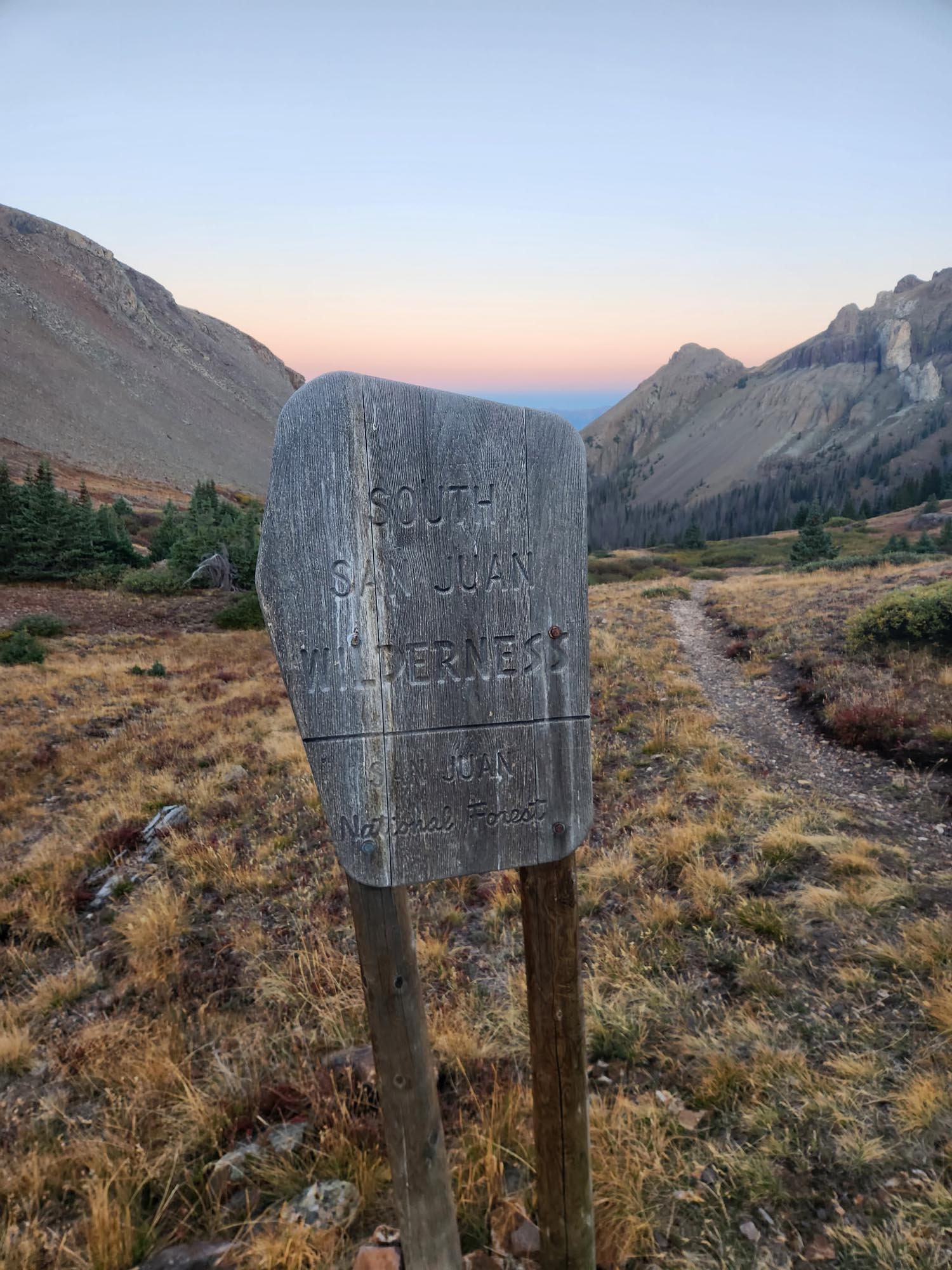
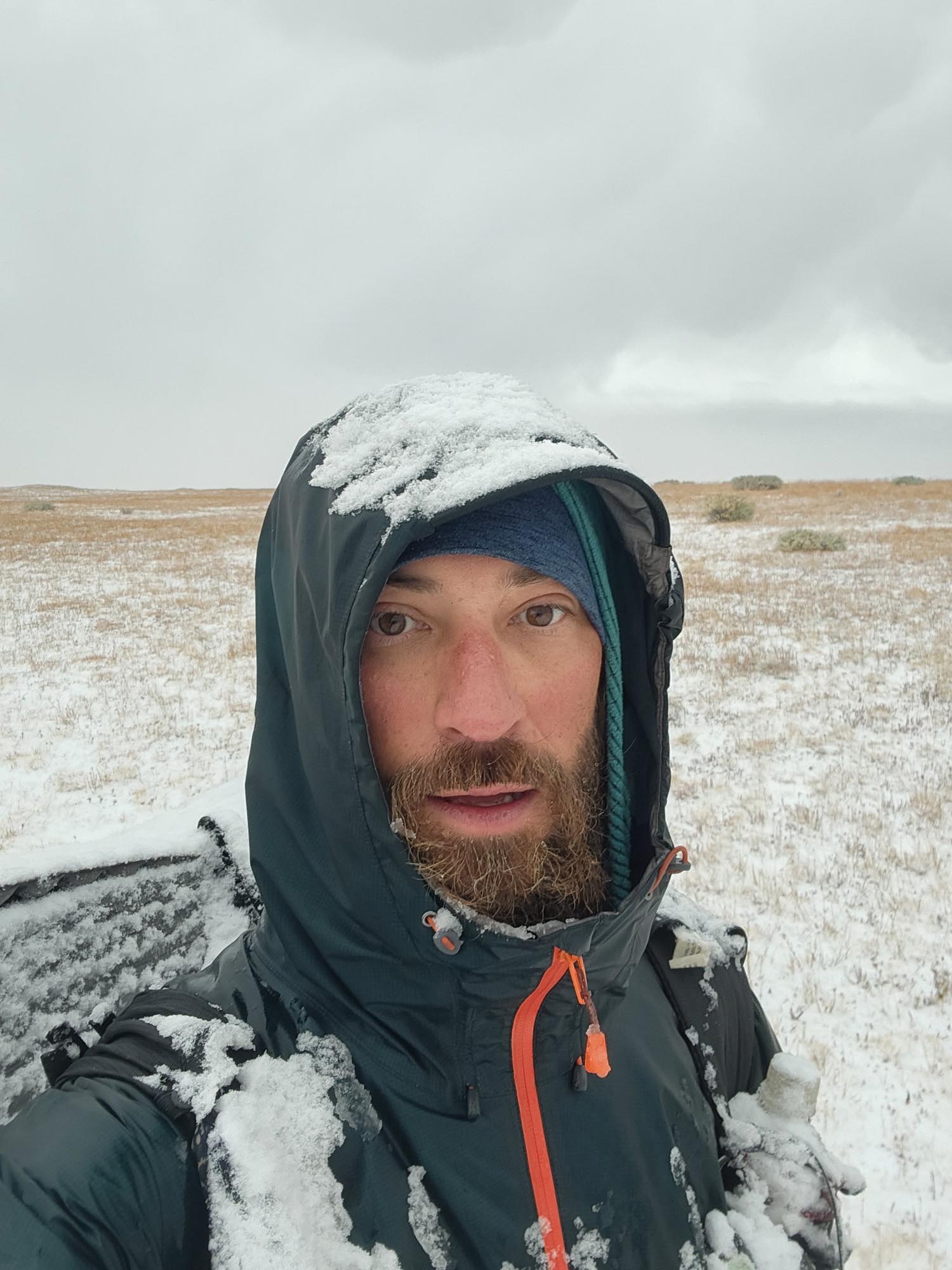
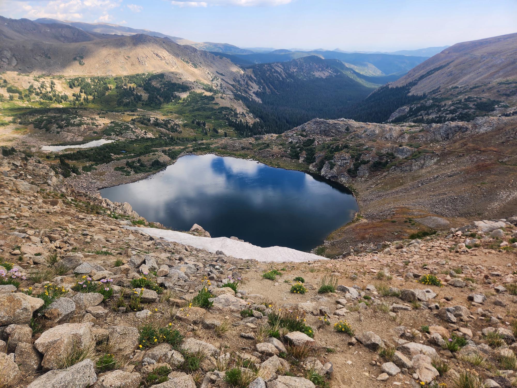
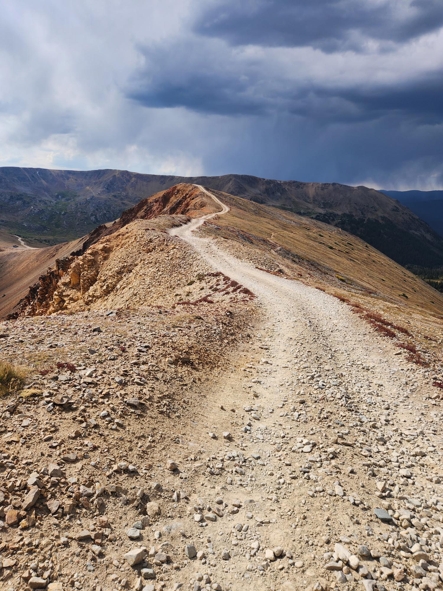
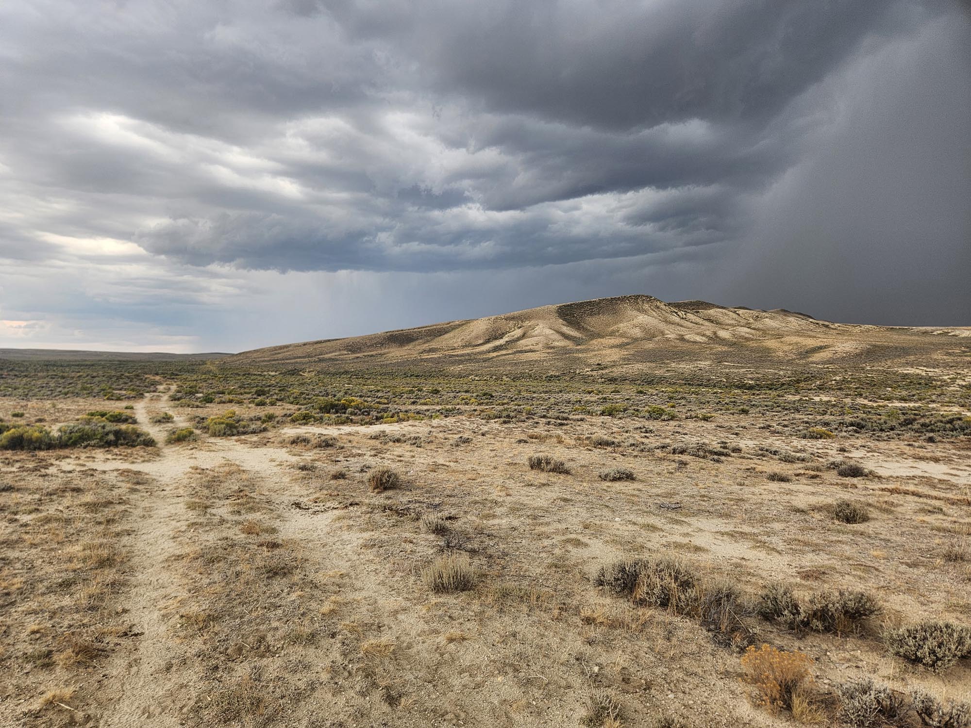
Frozen and five miles before the road, I decided to call it. Chattering teeth, my numb, fat sausage fingers. The wind and hail were whipping my legs, but they were so cold I couldn’t feel them anymore. Above 12,000 feet in a storm, feeling the onset of hypothermia—pushing on would not be a smart thing. I’ve been an idiot plenty of times in my life, but this wouldn’t be a good time to prove it.

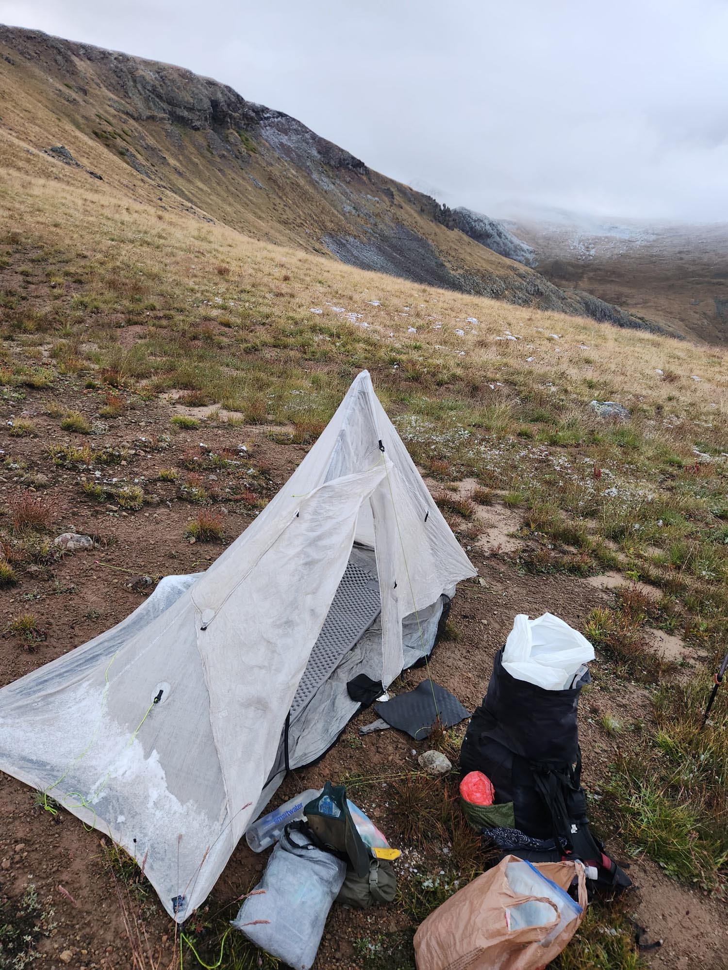
At the top of the plateau, there was a low spot 30 feet off trail. Enough room to pitch my tent and get some sort of reprieve from the storm. Cold and wet, the night was miserable—hardly able to move and only doing so when I started cramping up from staying in a single position for hours. I would have to roll over, cold and wet. This was the bivy situation I wanted to avoid, and I just kept thinking about staying at the Butterfly Hostel days before and how I could be out of this storm and in town if I hadn’t stayed there. I know the trail will bite you every once in a while, but my decision to be lazy and stay there created this frozen mess.

It was so hard getting packed up and moving the next morning, but I survived at 12,300 feet in the storm. With 5.1 miles to the road, I hiked hard. It was whipping wind and snowing for the first four miles until I started to descend. Funny—I ran into the two ladies I had met the morning before. They were doing a section, and I told them it wasn’t pretty up there. They said they’d check it out, and if they decided to turn around, they’d give me a ride down to Lake City.

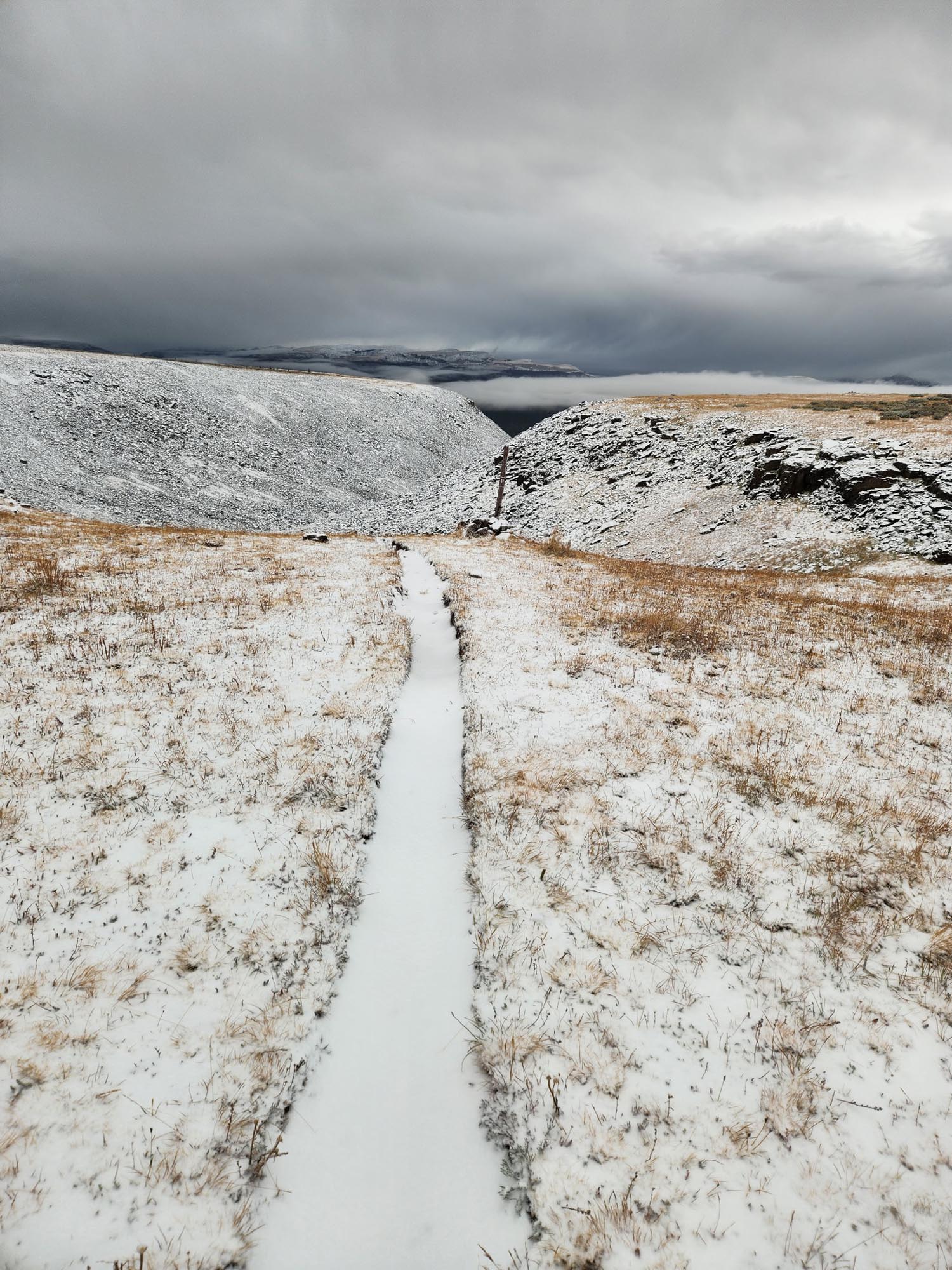
I made it to the road at 8:30 a.m. It was raining now. As I stuck my thumb out, shivering, another poor soul came wandering from the parking lot on the other side. His name was Robert, a young kid hiking the Colorado Trail. He too was frozen, and we both stood there praying for the next car to pick us up. The next vehicle was a camper van that pulled into the parking lot across from us, did a loop around, and as they got to the exit, the driver gave us a peace sign and took off in the direction we needed to go. Really? You acknowledge us, see that we’re freezing, and take off in your big, overpriced Mercedes? I gave them the finger.

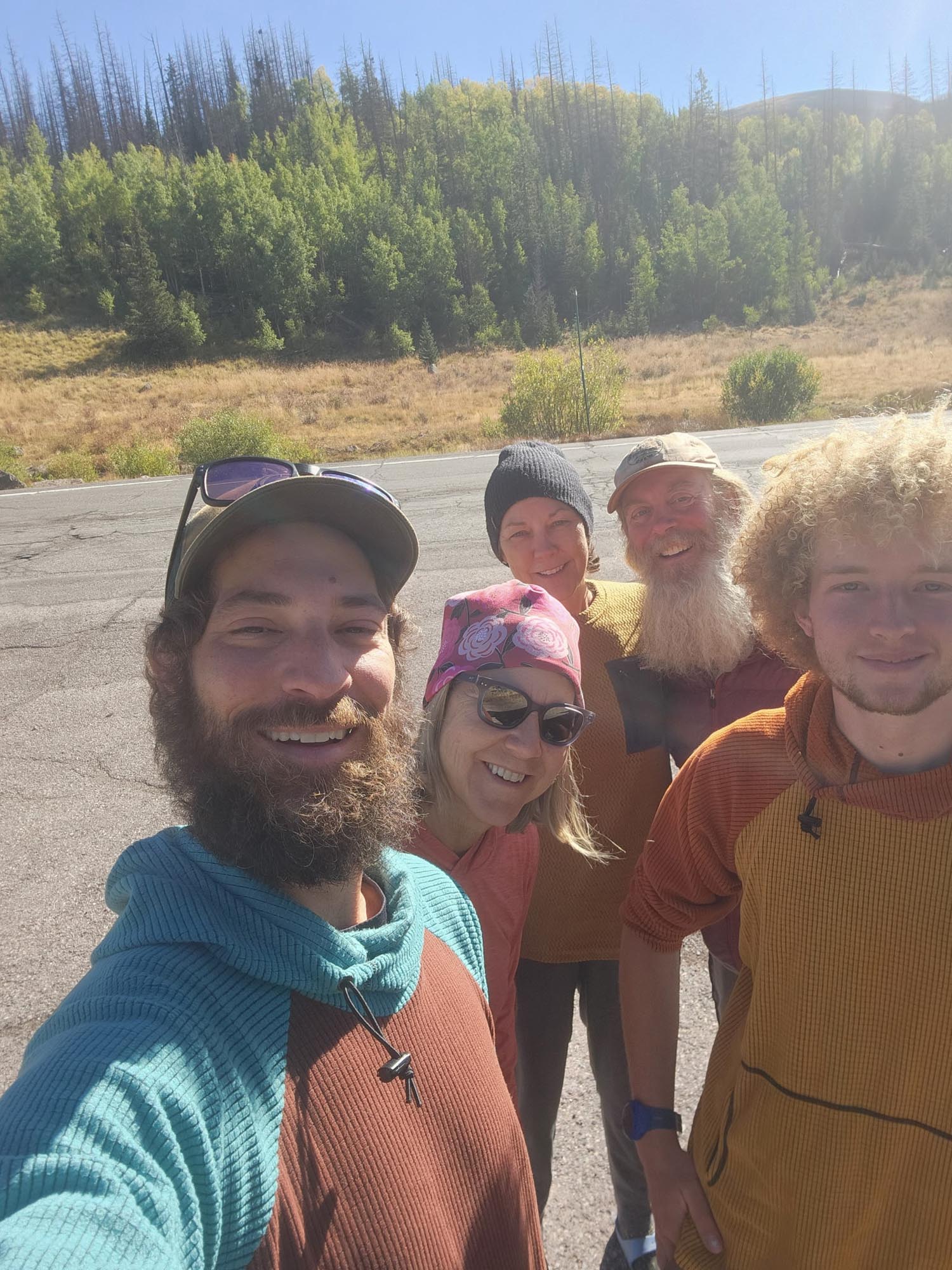
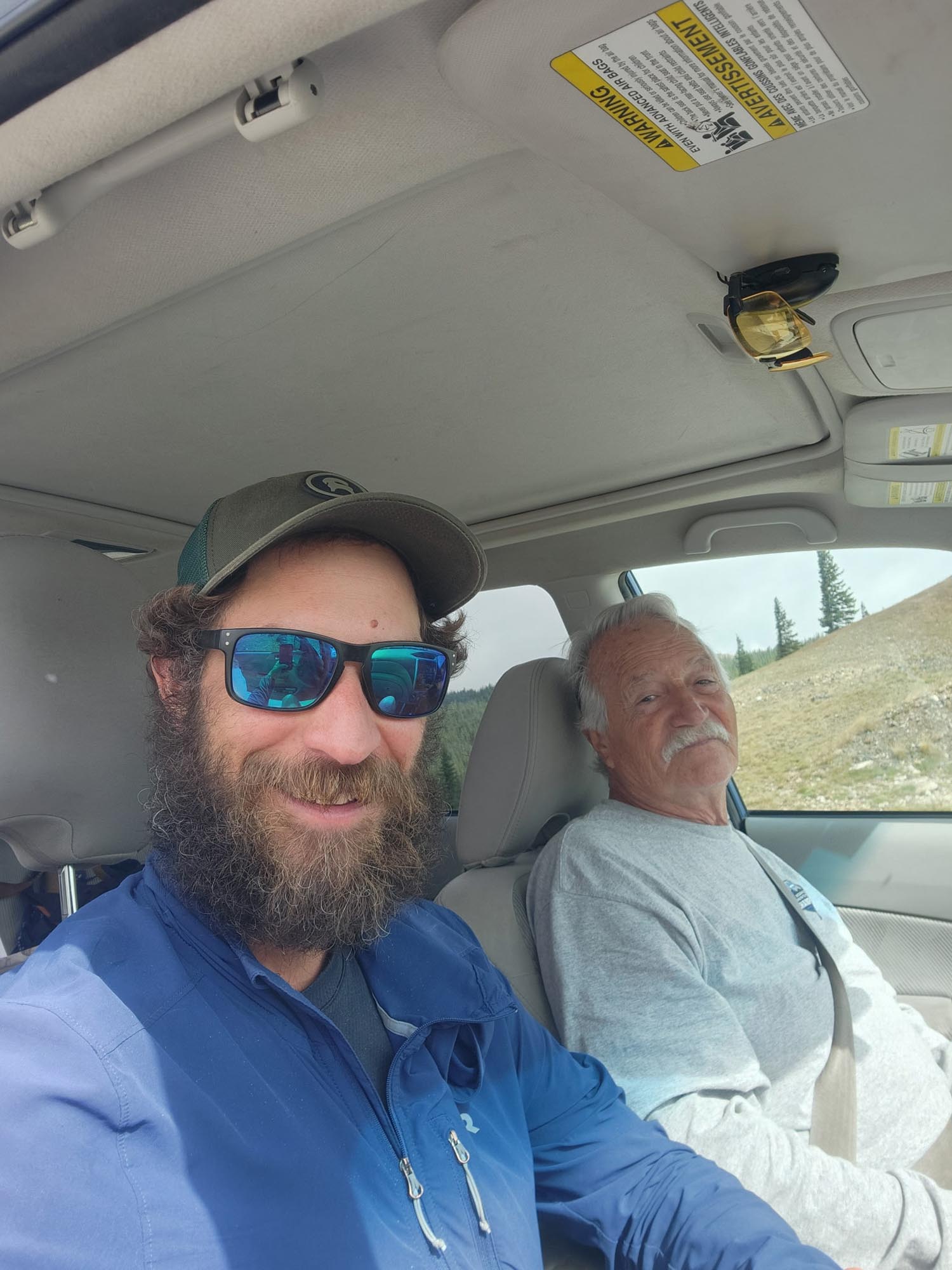
I told Robert about the two women I had passed on the hike. I was starting to lose hope after an hour. I should’ve scared them more about the weather and turned them around with me. At approximately 9:30, coming down the trail were the ladies—Kelly and Kathy. Lifesavers. They gave us a ride down, complete with all their hiker food, a free hotel room in town, breakfast, and a ride back up to the trail in the morning. Amazing trail angels. It’s crazy how quickly you can go from the lowest of lows to the highest of highs out here.

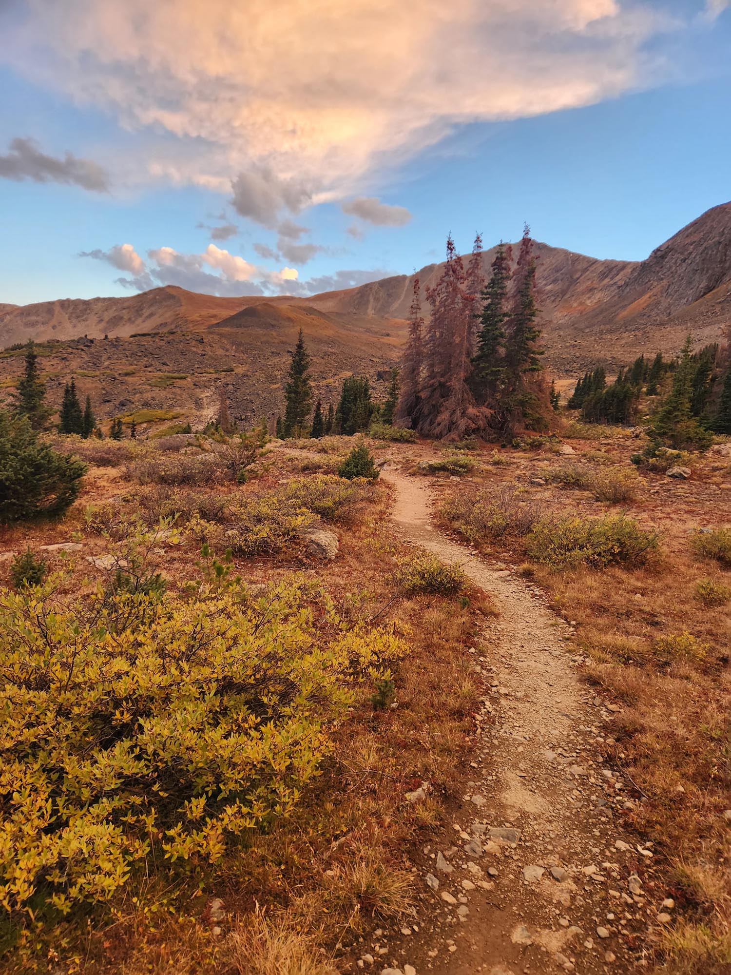
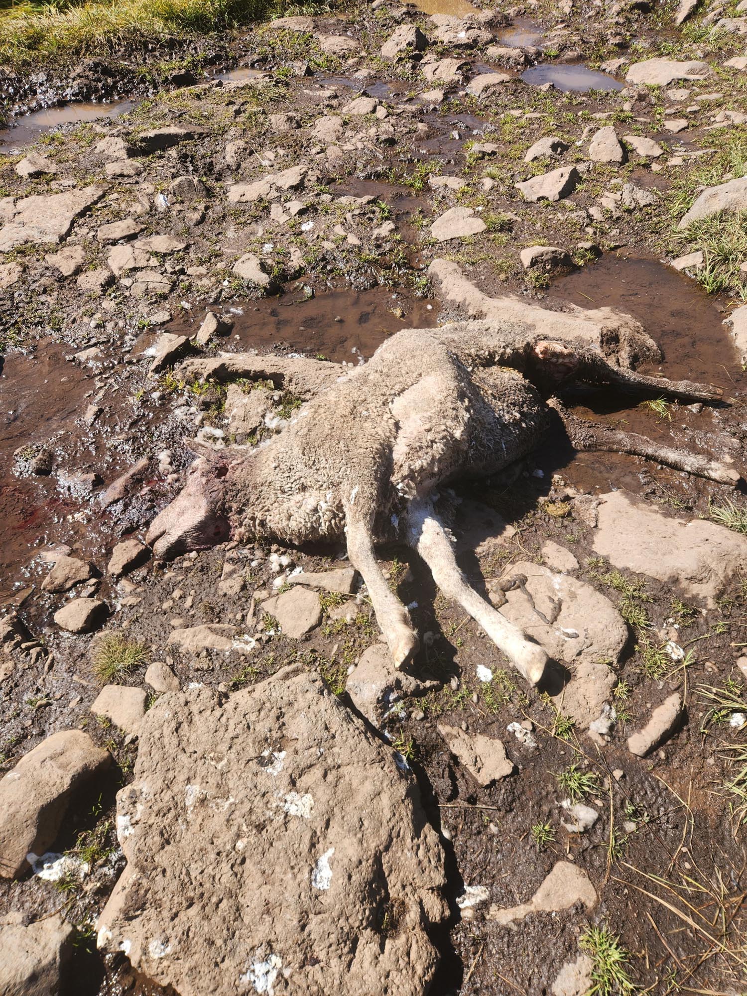
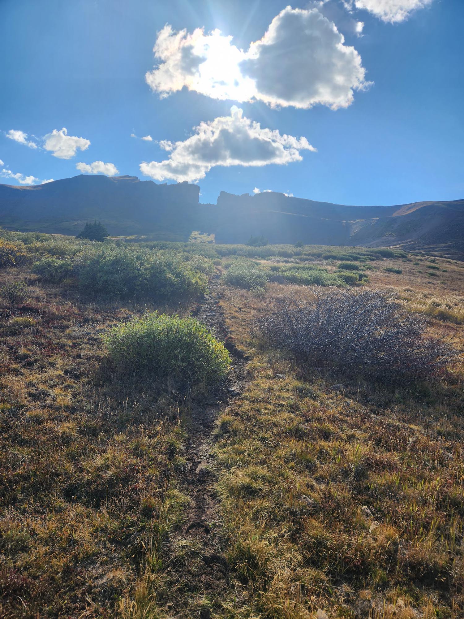
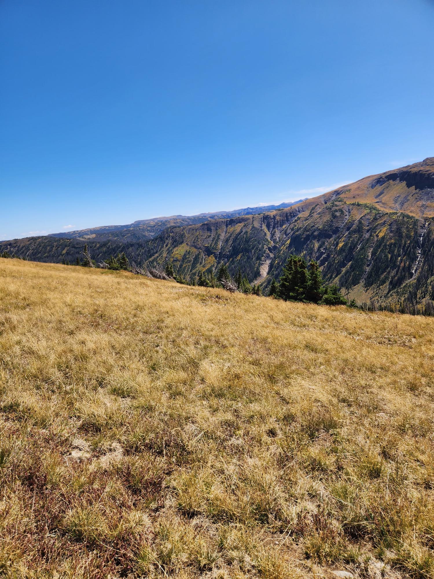
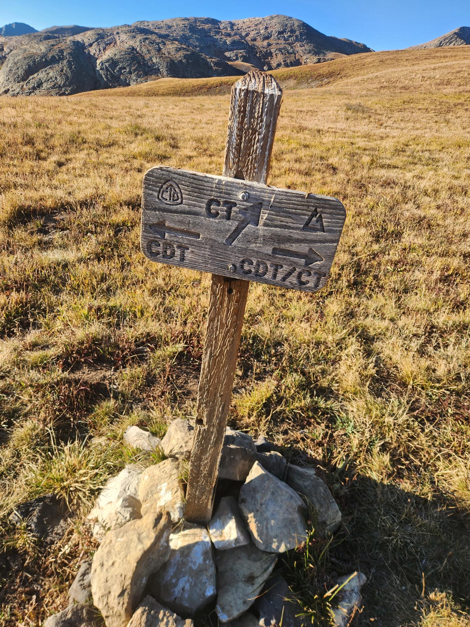
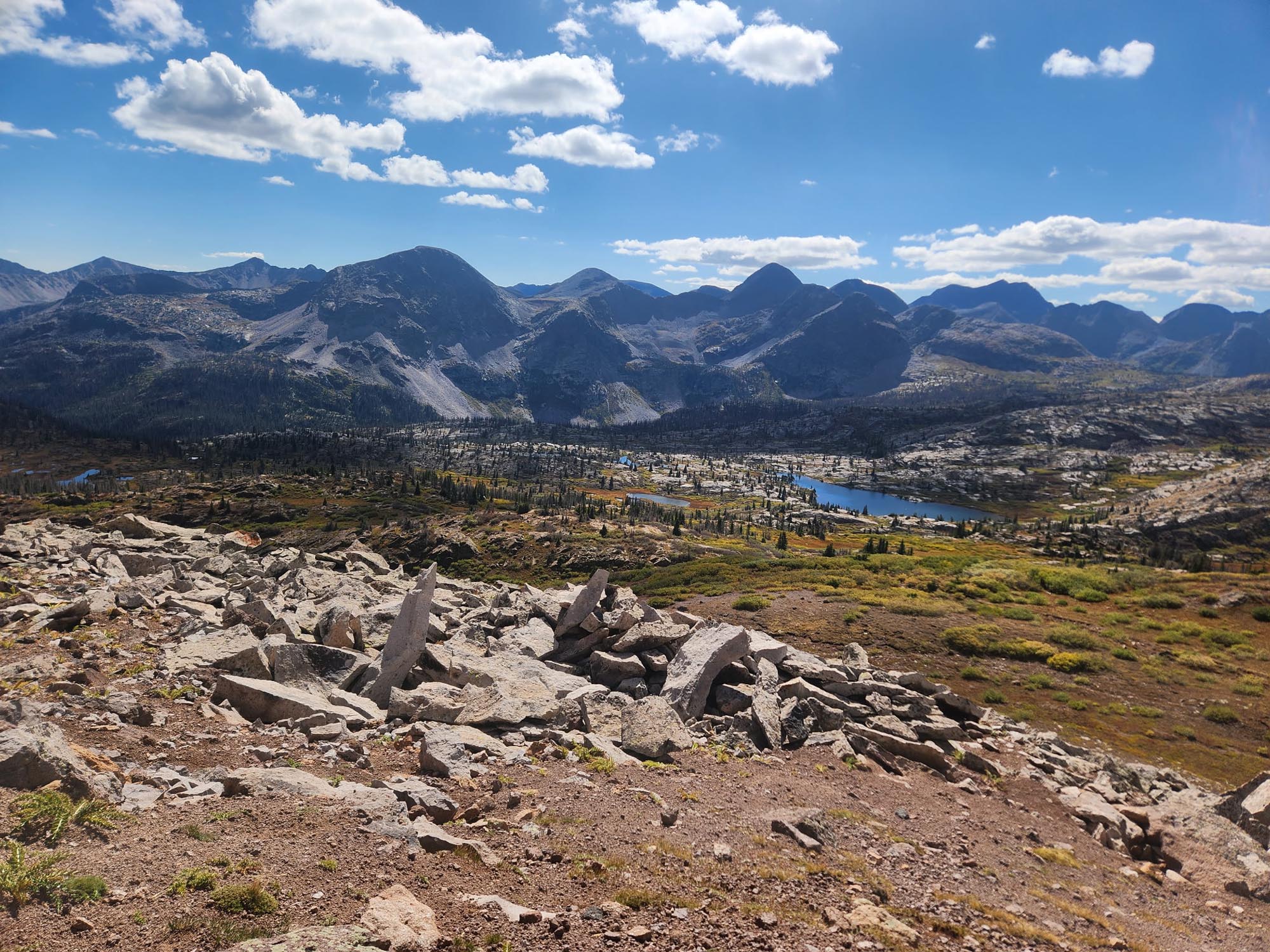
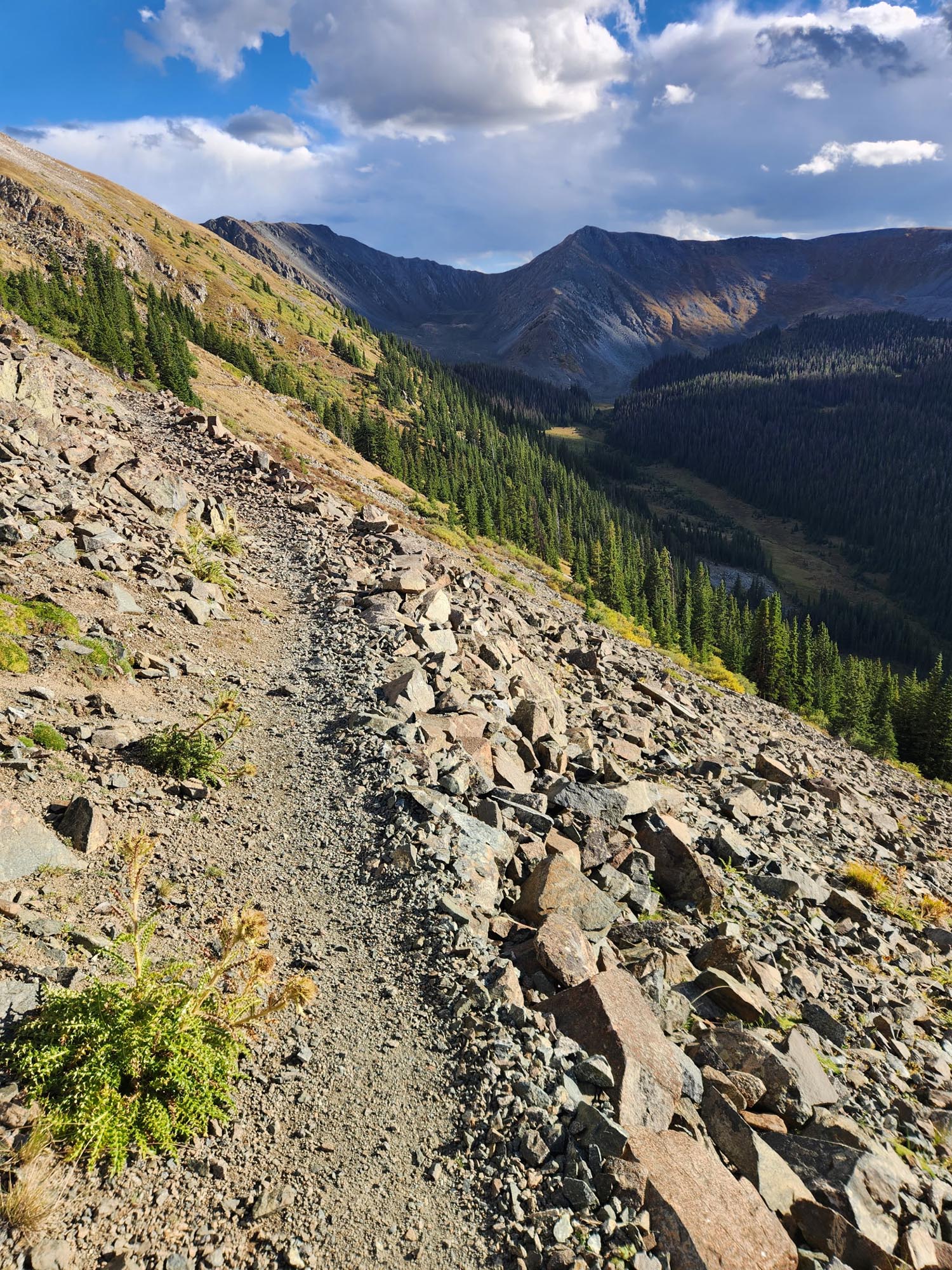
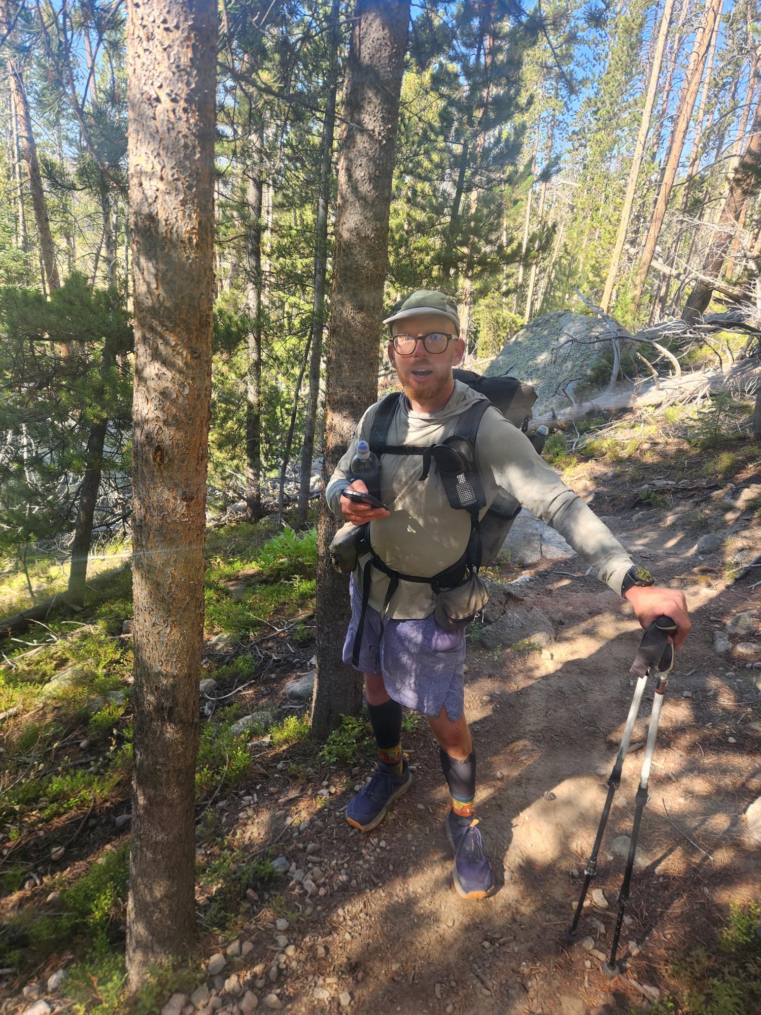
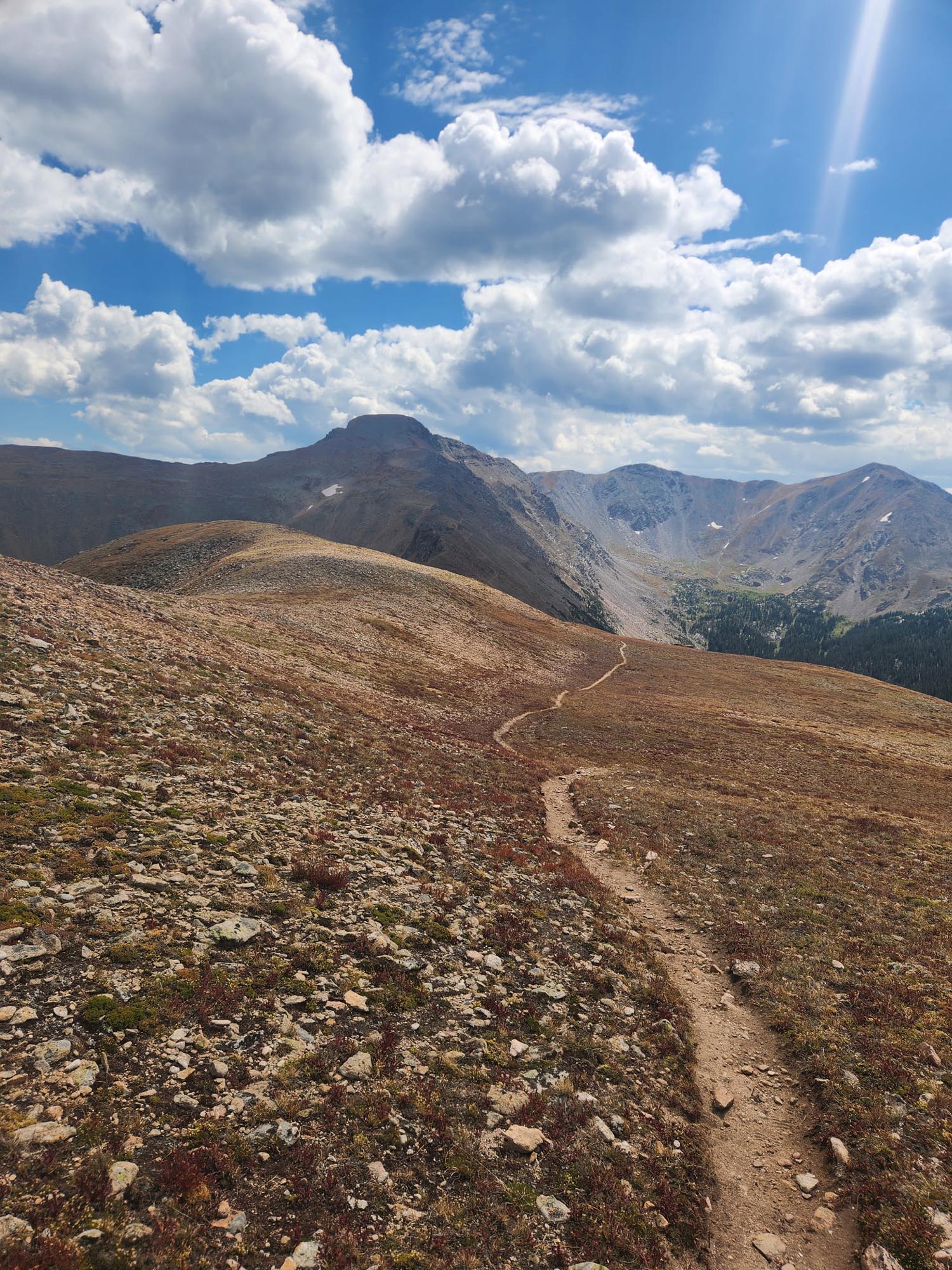
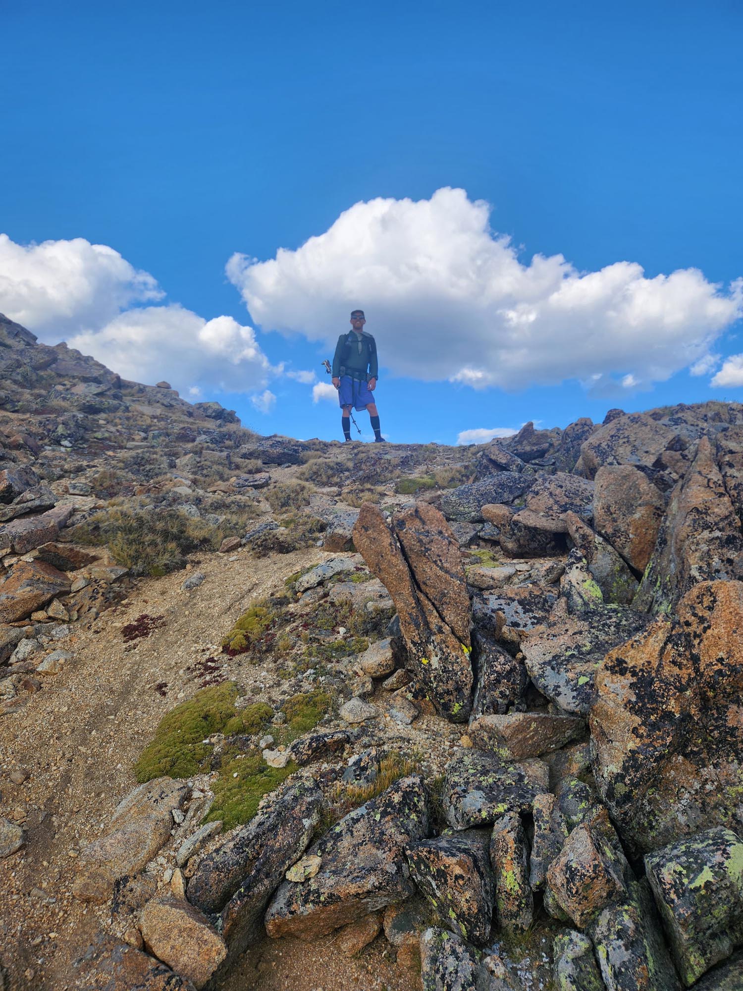
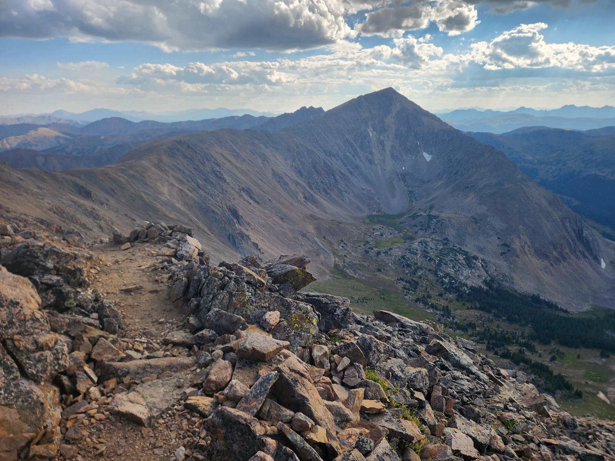
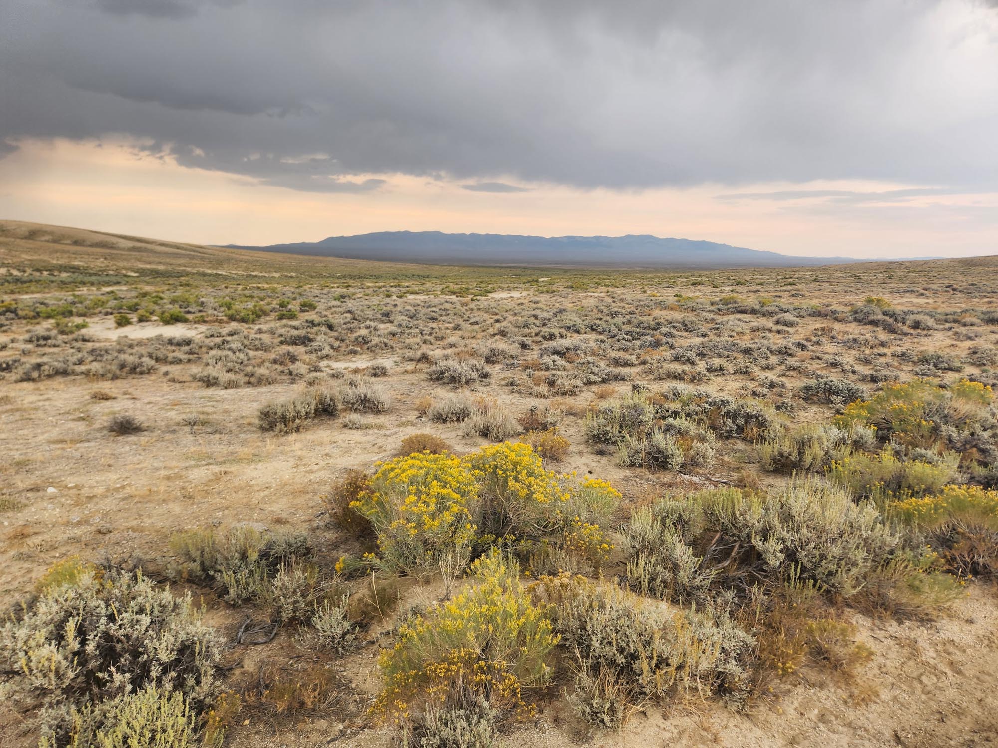
Back on trail about a mile later, I came upon a dead sheep. Fangs in the jugular—indicates a wolf attack. At least that’s what CSI has taught me. I lost Robert, a.k.a. Milk Man, a ways back, but I did run into the two Seths again. They didn’t want to do my pace anymore. After saying goodbye, I took off—back into the big mountains. A lot of hunters through here. The climbs were long, but that was fine as long as the weather held. 110 miles to Chama and lower elevation.

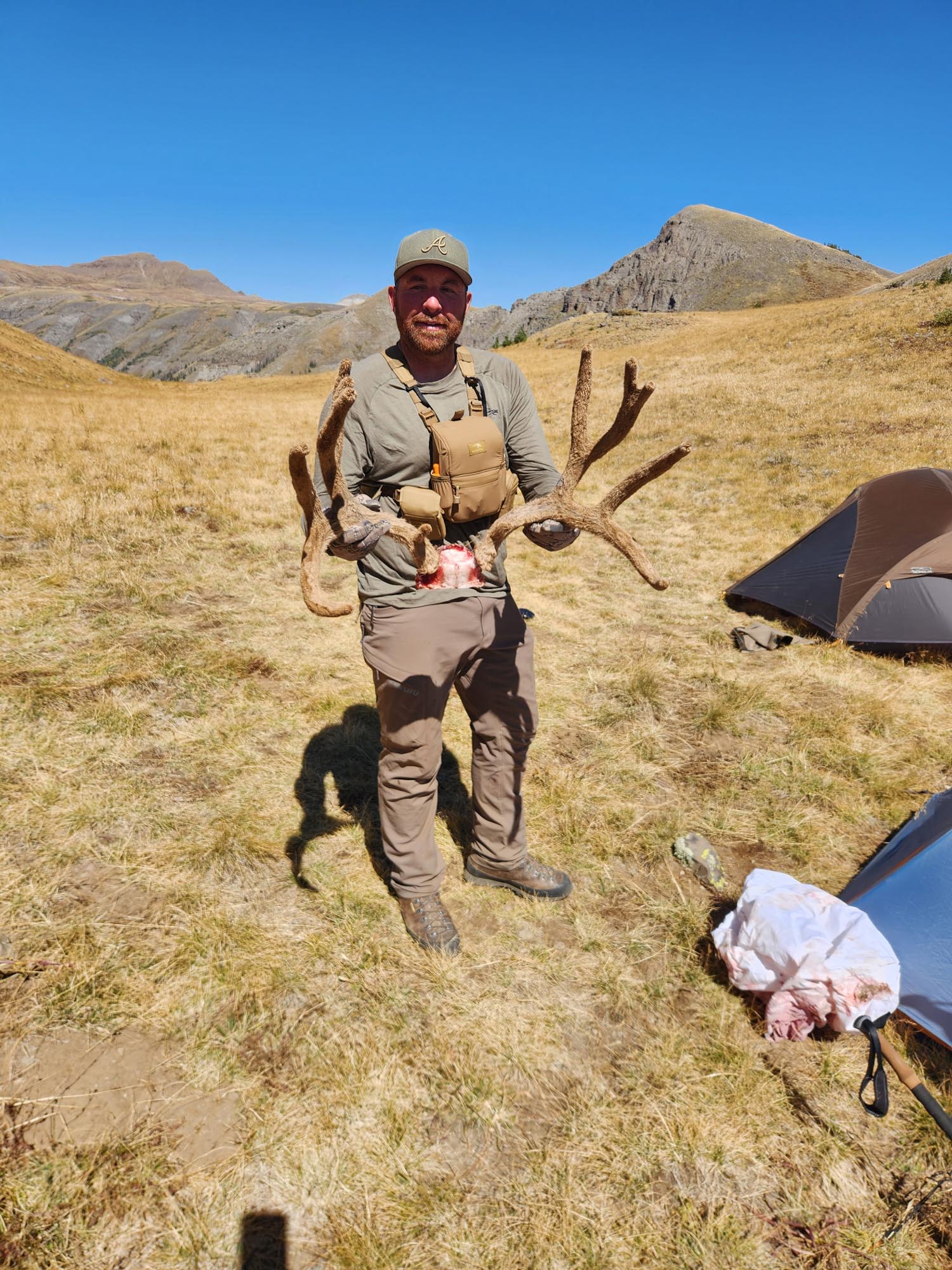
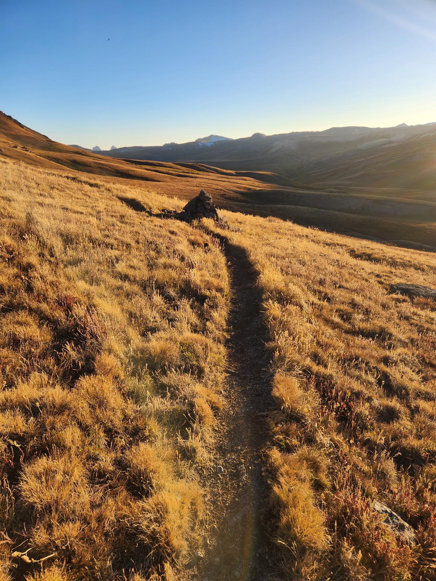
9,000 feet per day was average for ascent, doing mid-30s mileage. Nights were below zero. A lot of hunters—gunshots often. I wish I had brighter colors. Two hunters I met, a couple of Mormon boys from Utah, told me they’d killed a deer the day before. After field dressing it and carrying it all the way back to camp, they laid the meat out to dry, and coyotes had eaten the whole thing by the next morning. Somewhat demoralized, but they gave me food—including biscuits and gravy. They had a 10-hour drive ahead of them; I had 3,000 more miles.

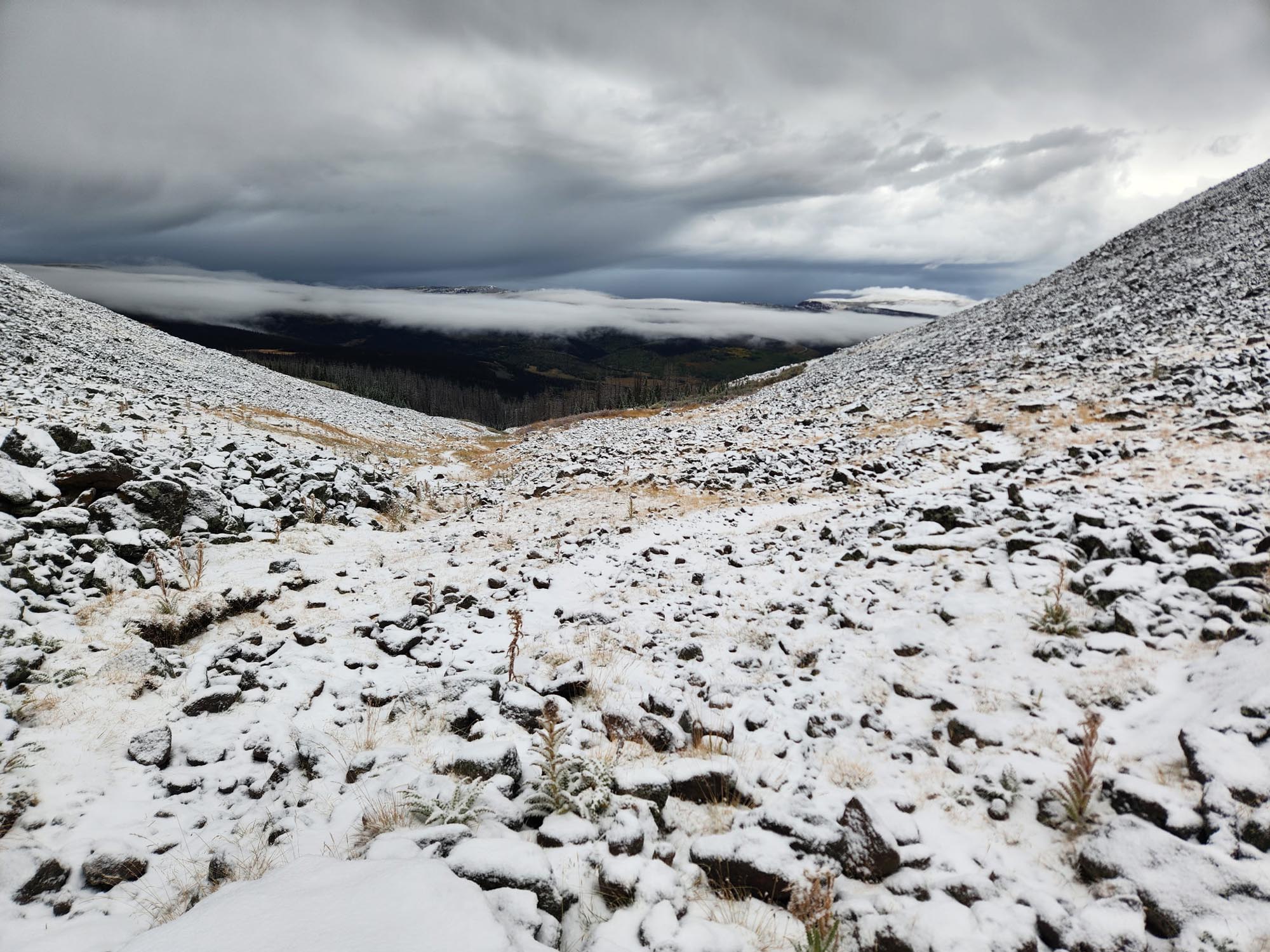
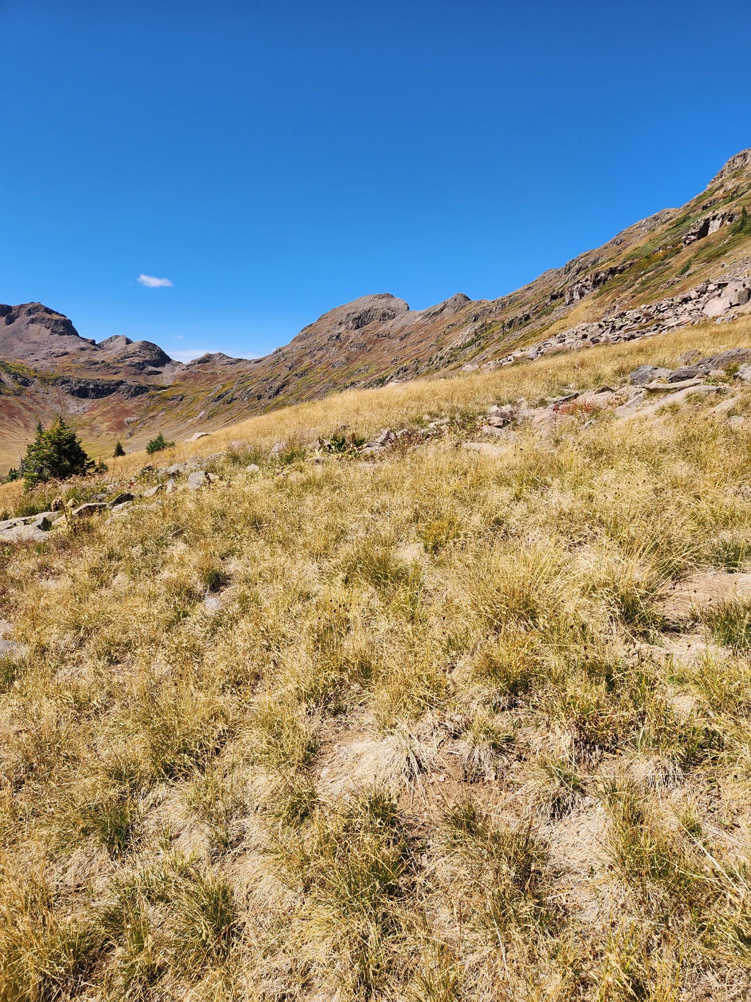
Making it to the campsite and lake that night after a hard-fought 39-mile day, I came upon five more hunters chilling around a campfire. I stayed there that night and hung out with Colt. The other guys slowly pulled the Irish goodbyes—something my friend Bob Mickle has perfected over the years. Froze again that night, and after one more good 1,000-foot climb in the morning, it was a speedy 15 miles to Cumbres Pass and a hitch into Chama.

The feeling of relief to be out of Colorado and those big mountains in mid-September was amazing. A tough state. Add in the storms, and it was really difficult. I made it through relatively unscathed. Unfortunately, two young hunters died in that bad storm, struck by lightning as they huddled underneath a tree to get out of the weather.

It’s easy to sometimes think I’m doing this great American adventure, but then the reality of the situation comes back tenfold, and I have to refocus on what this is—what it means to be outside for over seven months and 95% of the time. It’s hard. It’s dangerous.


Week 19: White River National Forest, CO to near Lake City, CO

Total Weekly Mileage: 240

“Rain Supreme”

This week started with a reroute through Copper Mountain Village, where a couple thousand people had showed up to see Third Eye Blind. I just ate a honey bun and kept walking. I saw them open for U2 when I was 10, and I wasn’t a big fan then—and I’m still not a fan now.

It started to rain again, and I had a big uphill through the ski area. I kept halfway up. I was excited to get to Leadville and pick up my Melly hoodie—and one for my niece. A Melly for Mel! The timing couldn’t have been better because it’s starting to get cold, and an additional layer is definitely needed.

Leadville was a quick in-and-out: eat, charge, resupply, and back on trail. I saw Squalo hitching into town when I arrived back at the trail. We talked for a minute, and he got a ride. The trail out was easy—no big climbs, actually kind of flat.

Each day has had some rain in the afternoon, which is fine for a couple days, but after a while it’s starting to get annoying. Around Twin Lakes a couple days later, there was a 4-mile, 2,000-foot climb up to Hope Pass and more big mountains.

I’ve been pushing hard to make it to Monarch Pass and the Butterfly Hostel to get my resupply box and my 10th pair of shoes. The plan was not to stay, but after taking a shower, it started to rain and I fell asleep on the couch—waking up later than I wanted to and deciding to just stay there for the night. This would end up being a big mistake.

Shane, the owner, made me a triple cheeseburger, and it was just me and two other people staying there. The hiker bubble I passed, and most of the southbound CDT hikers will be going to Trail Days in Leadville on September 12th. I think that’s kind of late—these mountains are formidable, and late-season hiking is dangerous through here.

I started early on that Friday with a goal to do 42 miles and make it to the road by 7:30. Hitching into Lake City is notoriously hard, and any attempts too late are futile. Out of the farmland and completely exposed, the weather turned. I met a couple young dudes hiking the Colorado Trail—both named Seth—and we hiked most of the day together, which really helped. When the weather sucks and you have other hikers to talk and distract with, it makes a difference.

Not many names on some of these mountain passes. Just “High Point” or “Panoramic View.” It was 2 p.m., and I wasn’t out of the woods yet.


Week 18: Lost Ranger Peak, CO to White River National Forest, CO

Total Weekly Mileage: 244.2

“On the Edge”

The beginning of the day looked good, but yet again, rain came in around 10 a.m. On and off, I wanted to stop when it started coming down hard, but after the day before, I had to keep pushing. Luckily, it stopped by 5:30 and just stayed cold and overcast for the remainder of the day. I was cold that night—really cold. If I rationed my food, I could make it to Grand Lake, but I needed to get some warmer clothes. Doing these big miles with little sleep wasn’t going to last long.

I made it to the highway by 11 a.m. the next morning and hitched into Steamboat Springs. After a light resupply—sushi and chicken wings, which I ate on the curb outside the grocery store, enjoying the looks from upper crusties thinking I was homeless—I picked up some mid-weight cross-country ski pants, a hat, and gloves. Back on trail by 2, with help from Richie and “Professor,” the road walk out of town was hot until the clouds closed in again. I pitched my tent and waited it out: 15 minutes of hard-pounding rain and hail.

The rest of the day was roadwalking—from paved to dirt to forest to 4×4 roads. These roads were the gradual beginning of getting up into the big mountains. I think they’re called the Rocky Mountains.

Getting into Grand Lake, I noticed in a trail register that a hiker I met on the PCT in ’22 had left that morning. I would catch Squalo the next morning. He was cowboy camping on the side of the trail with a group of four. He decided to hike with me. We had our work cut out for us—big mountains to climb and potential for bad weather within the next few days.

The plan was to push hard over some 13,000-foot steps that day: James Peak (13,500) and Mt. Flora (13,200), with a lot of other hard pulls resulting in over 10,000 feet of ascent and 39 miles for the day. Also, we needed to reach the pass for a Winter Park hitch before dusk. My homeless-looking—sorry, I mean unhoused-looking—self has trouble getting picked up, and when it’s dark, forget it. We had to hustle.

It was tough. The thinner air and three-mile uphills were rugged, but the views were spectacular, and it was great to hike with someone for a change. Mid-afternoon hit us with a hailstorm, but the summits were clear.

At 2:06 p.m., I hit the four-month mark of the hike with 4,185 miles. By 7:55, we made it to Berthoud Pass. By 8:15, we were on our way to Winter Park. After a quick pit stop at McDonald’s (four McChickens and a double quarter pounder), we checked into the Best Western. Resupply, shower, laundry, AYCE breakfast, and back on the trail by 11.

Not as hard as yesterday and shorter, with a nice paved road walk along I-70 to finish the day and put us at the base of Grey’s Peak (14,200). I was glad Squalo was going to be up and out with me at 5. With the afternoon weather looking sketchy, we crushed the ascent and topped out on Grey’s at 7:30. Did the usual Instachat/social media stuff and took off.

The hike off the top is harder moving south. Following the knife’s edge, staying as close to the ridgeline as possible—it’s some precarious hiking. Slow going and scree make it tough. By 3 p.m., we were surrounded by storm clouds and could see where it was really coming down behind us. We hiked fast and hard to outrun all of it. Being at 13,000 feet for most of the day meant complete exposure, and it was not a place to get hit with a storm.

By 6 p.m., we made it down to 11,000 feet and to where the CDT and the CT join. Into the woods and safe. The Colorado Trail is plush compared to what we had just gone through the last few days—single track, well-marked, plenty of water. It was great. 36 miles for the day.

I said goodbye to Squalo the next morning at 5 a.m. and took off. Got rained on a bit by the time I made it to Breckenridge. Just wanted a coffee and a doughnut and spent an hour charging my stuff and talking with another hiker I met named “No See-Em.” More rain back on trail, and I was fairly happy with my week when it ended around 240 miles.

I’ll try to be funnier for next week’s write-up, but I’m currently trying to pack up and get back on trail right now. Gotta get my pale ass through this state before the bad weather comes in. Which it has—and it’s been rough. But that story is for next week.


Week 17: Little Pine Creek, WY to Lost Ranger Peak, CO

Total Weekly Mileage: 242.2

“I Froze”

Onto the basin: 120 miles of flat, exposed high desert walking. Mostly roads, with cattle troughs for water. After picking up my eighth pair of shoes, fresh socks, and a new hat, I headed out of South Pass City. Rawlins was my next stop—a big town the trail goes right through. After 10 miles to finish the day, I did a 45, 43, and 23 into town. I wanted a 50, but lightning and thunderstorms forced me to pitch earlier than planned.

My phone was dead and I was out of food by the time I arrived in Rawlins, which was no big deal because I had planned on taking a nero and using the microwave in my room at the Econo Lodge to heat up multiple over-processed, shitty foods and put myself into a food coma for the remainder of the day. This plan was not to happen—or at least part of it. Rawlins was in a complete blackout when I arrived. Apparently, a lightning strike the night before had knocked out a transformer, and all power was out. The only place open was a food truck in town making killer burgers. Forty-five minutes later, I got mine and checked into the room with no power, then slept until it kicked back on. I was more tired than I thought and was out for two hours, which felt like fifteen minutes.

I headed over to the grocery store, which had thrown out all their frozen food and deli items—basically anything that needed refrigeration was gone. My food options were basically the things I buy for the trail, so no microwave usage for me! Walmart had the same issue. Apparently, the power had been out since 8 p.m. the night before, and it was 1 p.m. the next day by this point. I was able to buy a new 20,000 mAh power bank. No more messing around with power or waiting forever for things to charge. I now had 30,000 mAh in total.

I was back on trail at 9:30 the next morning, well-fed and well-rested. The weather was perfect, and the road walk would be long. I caught six hikers taking a hitch 30 miles up trail. There have been so many people skipping—it seems like it’s getting worse every year. I feel bad for the hikers who actually hike the trails.

The sky was clear when I called it a day at 10:45, so I decided to cowboy camp under the stars. At 3:30 a.m., I was getting rained on. Instead of setting up my tent, I just started hiking. Groggy and grumpy, I pushed on in the rain, expecting the sky to clear at some point so I could dry all my things. This never happened. By 10 a.m., I was soaked to the bone. The wind was whipping too, cutting right through all five layers I had on. I couldn’t feel my fingers and was paranoid about pulling my phone out too much, worried it would get destroyed.

The small town of Encampment was not part of my plan, but I needed to get dry and warm. By 12:30, I reached the road—shivering and spent. It was so foggy I didn’t think I’d ever get a ride, but as luck would have it, the first truck to pass stopped for me. Brian saved me. He dropped me off in town, and I got one of the last remaining cabins. No TV, but dry and a hot shower was all I cared about. There are always a few showers I remember on each one of these hikes, and this would be one of them (the other was back in Chester, CA, when the pay shower cut out on me while I was covered in soap).

Back on trail at 10:30 the next day, thanks to a cool dude named Jimmy, I pushed hard to make it to the border of Colorado. I did by 5:45 and ate and talked with “Rabbit,” who, only two months ago, had left his Amish family to pursue thru-hiking. I asked if his real name was Jedadiah—it was Ben. I pushed another 10 miles out of there, and the next day started hitting rain yet again, but was still able to hit a respectable mileage for the week, even with two half days.

Now it’s onto the big mountains, and it’s starting to get chilly.